Gloucester: St Oswald's Priory, Council's info panel
Introduction
The photograph on this page of Gloucester: St Oswald's Priory, Council's info panel by Alby as part of the Geograph project.
The Geograph project started in 2005 with the aim of publishing, organising and preserving representative images for every square kilometre of Great Britain, Ireland and the Isle of Man.

There are currently over 7.5m images from over 14,400 individuals and you can help contribute to the project by visiting https://www.geograph.org.uk
Gloucester: St Oswald's Priory, Council's info panel
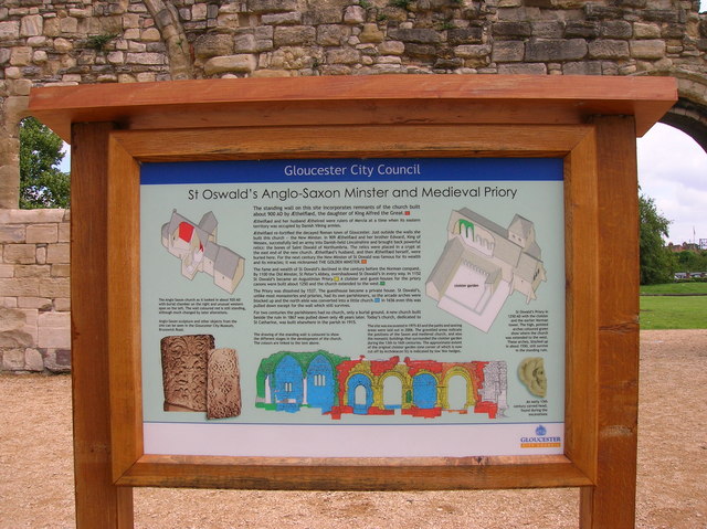
Image: © Alby Taken: 16 Jul 2007
This information panel was situated near the St Oswald's Priory in Gloucester. You can get all information necessary about this priory. However you can't find it in there any more because obviously it was vandalised.
Images are licensed for reuse under creativecommons.org/licenses/by-sa/2.0
Image Location
Latitude
51.869313
Longitude
-2.248311