Richmond Lock and half-tide barrier
Introduction
The photograph on this page of Richmond Lock and half-tide barrier by David Hawgood as part of the Geograph project.
The Geograph project started in 2005 with the aim of publishing, organising and preserving representative images for every square kilometre of Great Britain, Ireland and the Isle of Man.

There are currently over 7.5m images from over 14,400 individuals and you can help contribute to the project by visiting https://www.geograph.org.uk
Richmond Lock and half-tide barrier
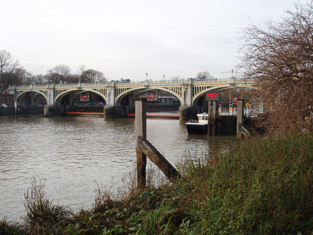
Image: © David Hawgood Taken: 19 Dec 2008
The level of The Thames between Teddington Lock and Richmond Lock is kept at or above half-tide level by this barrier. Above half-tide the barrier is lowered and boats can pass over it. Below half-tide, as in the photo, the barrier is raised and boats have to use the lock.
Images are licensed for reuse under creativecommons.org/licenses/by-sa/2.0
Image Location


Leaflet Map data © OpenStreetMap
Latitude
51.461891
Longitude
-0.317221