Hendon Park
Introduction
The photograph on this page of Hendon Park by Martin Addison as part of the Geograph project.
The Geograph project started in 2005 with the aim of publishing, organising and preserving representative images for every square kilometre of Great Britain, Ireland and the Isle of Man.

There are currently over 7.5m images from over 14,400 individuals and you can help contribute to the project by visiting https://www.geograph.org.uk
Hendon Park
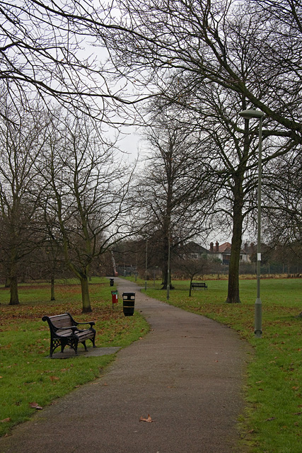
Image: © Martin Addison Taken: 14 Dec 2008
Looking along the footpath from Shirehall Lane to Renters Avenue and Cheyne Walk. The bridge carrying the path over the Northern Line is visible in the distance. The pronounced slope of the ground in the park, leading down to the River Brent, is evident in this view.
Images are licensed for reuse under creativecommons.org/licenses/by-sa/2.0
Image Location
Latitude
51.580662
Longitude
-0.218589