Transition in Gorbals housing
Introduction
The photograph on this page of Transition in Gorbals housing by Stephen Sweeney as part of the Geograph project.
The Geograph project started in 2005 with the aim of publishing, organising and preserving representative images for every square kilometre of Great Britain, Ireland and the Isle of Man.

There are currently over 7.5m images from over 14,400 individuals and you can help contribute to the project by visiting https://www.geograph.org.uk
Transition in Gorbals housing
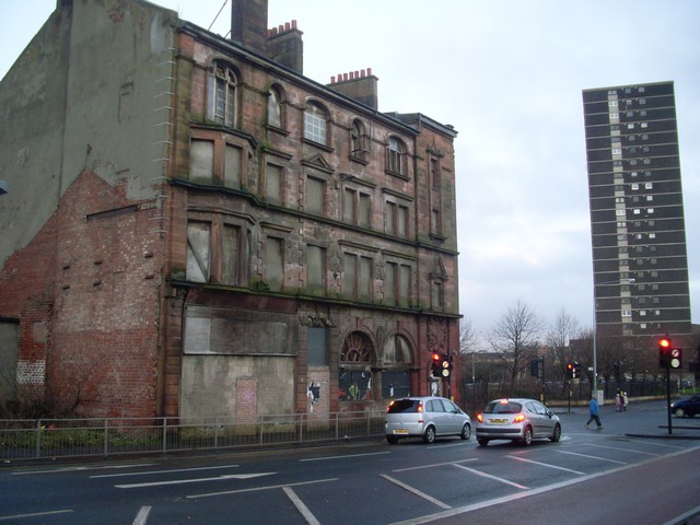
Image: © Stephen Sweeney Taken: 17 Dec 2008
To the left is a derelict tenement building, which was historically very typical of the Gorbals area. The highrise flat to the right is typical of the 1960s redevelopment program designed to regenerate the area, but which most will agree failed to do so.
Images are licensed for reuse under creativecommons.org/licenses/by-sa/2.0
Image Location
Latitude
55.850137
Longitude
-4.254273