St.Nicholas' church
Introduction
The photograph on this page of St.Nicholas' church by Richard Croft as part of the Geograph project.
The Geograph project started in 2005 with the aim of publishing, organising and preserving representative images for every square kilometre of Great Britain, Ireland and the Isle of Man.

There are currently over 7.5m images from over 14,400 individuals and you can help contribute to the project by visiting https://www.geograph.org.uk
St.Nicholas' church
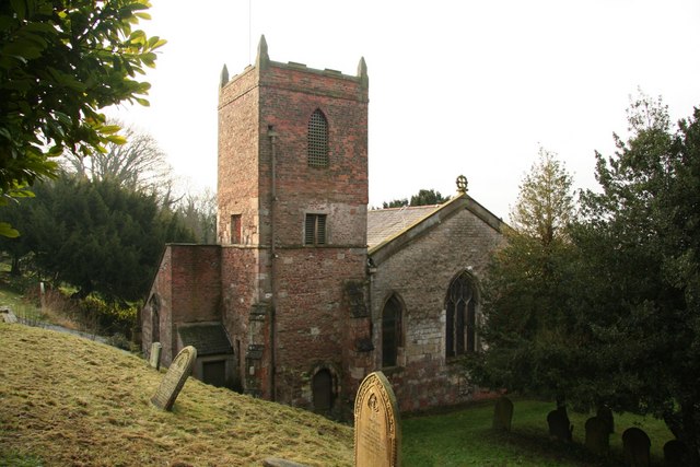
Image: © Richard Croft Taken: 15 Dec 2008
Kelly's 19th century directory refers to St.Nicholas' as "a mutilated remnant of a much larger church" .... bits of Norman masonry, 13th, 14th and 18th century work, a chancel by Hodgson Fowler in 1889, all jumbled up and turned 90 degrees so the chancel is actually to the south and the tower to the east.
Images are licensed for reuse under creativecommons.org/licenses/by-sa/2.0
Image Location
Latitude
53.674874
Longitude
-0.505389