Percy Street (pedestrianised section), Rodbourne
Introduction
The photograph on this page of Percy Street (pedestrianised section), Rodbourne by P L Chadwick as part of the Geograph project.
The Geograph project started in 2005 with the aim of publishing, organising and preserving representative images for every square kilometre of Great Britain, Ireland and the Isle of Man.

There are currently over 7.5m images from over 14,400 individuals and you can help contribute to the project by visiting https://www.geograph.org.uk
Percy Street (pedestrianised section), Rodbourne
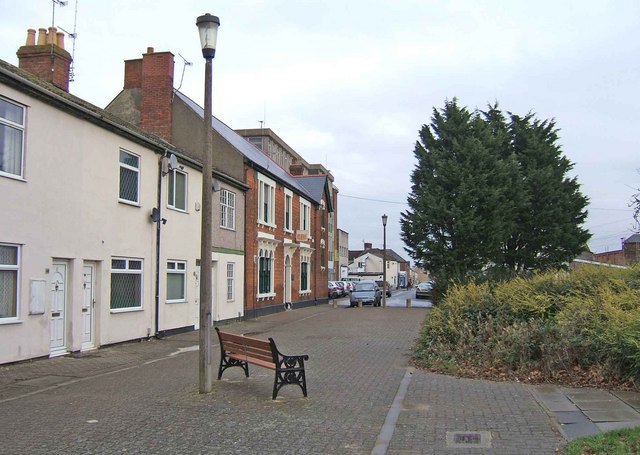
Image: © P L Chadwick Taken: 12 Dec 2008
Part of the pedestrianised section of Percy Street, looking towards Rodbourne Road. The red brick building on the left is the Even Swindon Club Image The grass and vegetation on the right has replaced demolished buildings. For a view in the other direction Image
Images are licensed for reuse under creativecommons.org/licenses/by-sa/2.0
Image Location
Latitude
51.564429
Longitude
-1.801443