Percy Street (pedestrianised section), Rodbourne
Introduction
The photograph on this page of Percy Street (pedestrianised section), Rodbourne by P L Chadwick as part of the Geograph project.
The Geograph project started in 2005 with the aim of publishing, organising and preserving representative images for every square kilometre of Great Britain, Ireland and the Isle of Man.

There are currently over 7.5m images from over 14,400 individuals and you can help contribute to the project by visiting https://www.geograph.org.uk
Percy Street (pedestrianised section), Rodbourne
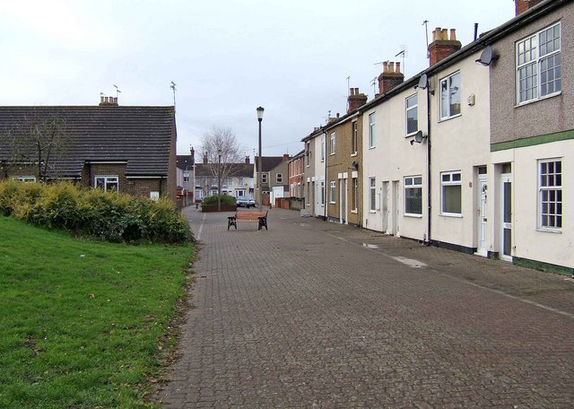
Image: © P L Chadwick Taken: 12 Dec 2008
The middle part of the street has been pedestrianised. As part of this process some buildings on the left were demolished. They were replaced partly by the grassed area, and partly by a new terrace of homes built at right angles to the rest of the street. The buildings on the left in this view are part of that terrace.
Images are licensed for reuse under creativecommons.org/licenses/by-sa/2.0
Image Location
Latitude
51.564519
Longitude
-1.801443