The town of Ledbury from Ridge Hill
Introduction
The photograph on this page of The town of Ledbury from Ridge Hill by Pauline E as part of the Geograph project.
The Geograph project started in 2005 with the aim of publishing, organising and preserving representative images for every square kilometre of Great Britain, Ireland and the Isle of Man.

There are currently over 7.5m images from over 14,400 individuals and you can help contribute to the project by visiting https://www.geograph.org.uk
The town of Ledbury from Ridge Hill
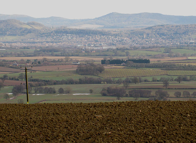
Image: © Pauline E Taken: 14 Dec 2008
On the horizon, the Malvern Hills with the Herefordshire Beacon (338m) almost in the centre, then a range of unnamed hills behind the town with the prominent spire of the church of St Michael and All Angels. The River Leadon and Preston Brook cut unseen, through the image.
Images are licensed for reuse under creativecommons.org/licenses/by-sa/2.0
Image Location
Latitude
52.009427
Longitude
-2.534498