Chuley Bridge
Introduction
The photograph on this page of Chuley Bridge by Derek Harper as part of the Geograph project.
The Geograph project started in 2005 with the aim of publishing, organising and preserving representative images for every square kilometre of Great Britain, Ireland and the Isle of Man.

There are currently over 7.5m images from over 14,400 individuals and you can help contribute to the project by visiting https://www.geograph.org.uk
Chuley Bridge
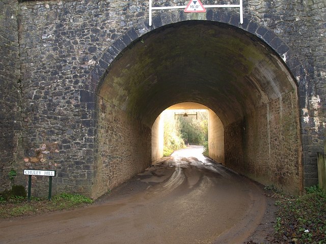
Image: © Derek Harper Taken: 12 Dec 2008
When does a bridge becomes a tunnel? This one is at least 25 metres long. Chuley Road passes beneath the A38 Devon Expressway as it bypasses Ashburton, and becomes Chuley Hill.
Images are licensed for reuse under creativecommons.org/licenses/by-sa/2.0
Image Location
Latitude
50.510322
Longitude
-3.756227