Hendon Lane
Introduction
The photograph on this page of Hendon Lane by Martin Addison as part of the Geograph project.
The Geograph project started in 2005 with the aim of publishing, organising and preserving representative images for every square kilometre of Great Britain, Ireland and the Isle of Man.

There are currently over 7.5m images from over 14,400 individuals and you can help contribute to the project by visiting https://www.geograph.org.uk
Hendon Lane
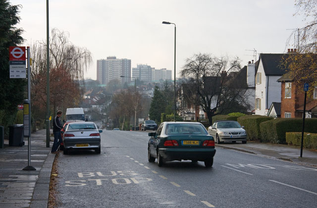
Image: © Martin Addison Taken: 14 Dec 2008
Seen at the bus stop for Crooked Usage. Beyond, the road becomes Finchley Lane as it climbs from the Dollis Valley up to Hendon. The tower block on the left of the group in the centre is located behind Sentinel Square on the Belle Vue estate. The next one is on Sentinel Square whilst the right hand pair are on New Brent Street.
Images are licensed for reuse under creativecommons.org/licenses/by-sa/2.0
Image Location
Latitude
51.59323
Longitude
-0.208309