Central station, Belfast
Introduction
The photograph on this page of Central station, Belfast by Albert Bridge as part of the Geograph project.
The Geograph project started in 2005 with the aim of publishing, organising and preserving representative images for every square kilometre of Great Britain, Ireland and the Isle of Man.

There are currently over 7.5m images from over 14,400 individuals and you can help contribute to the project by visiting https://www.geograph.org.uk
Central station, Belfast
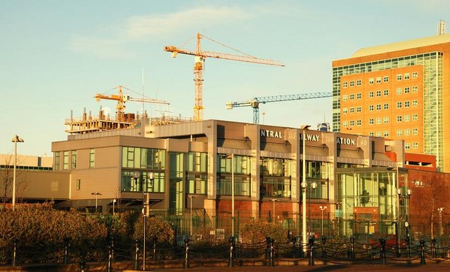
Image: © Albert Bridge Taken: 14 Dec 2008
If truth be told, Belfast Central has more than a touch of the “problem for every solution” about it. Built on the site of the old Maysfields livestock sidings, it owes its existence to the Westlink road Image The road, as originally conceived, was to have been elevated and would have cut through part of the existing Gt Victoria Street station. The public enquiry rejected that plan but Gt Victoria Street had been closed and the disused Central line had been re-opened and the station built. It had the advantage of allowing through running between the Bangor and Dublin lines. The disadvantages are its remoteness from the commercial centre, a tight curve meaning wide gaps between the platform and trains and lack of proper pick up/set down accommodation. It opened in April 1976. The solution was to re-open Gt Victoria Street Image (but not for Dublin trains).
Images are licensed for reuse under creativecommons.org/licenses/by-sa/2.0
Image Location
Latitude
54.595298
Longitude
-5.916868