Grazing on Yennadon Down
Introduction
The photograph on this page of Grazing on Yennadon Down by Tony Atkin as part of the Geograph project.
The Geograph project started in 2005 with the aim of publishing, organising and preserving representative images for every square kilometre of Great Britain, Ireland and the Isle of Man.

There are currently over 7.5m images from over 14,400 individuals and you can help contribute to the project by visiting https://www.geograph.org.uk
Grazing on Yennadon Down
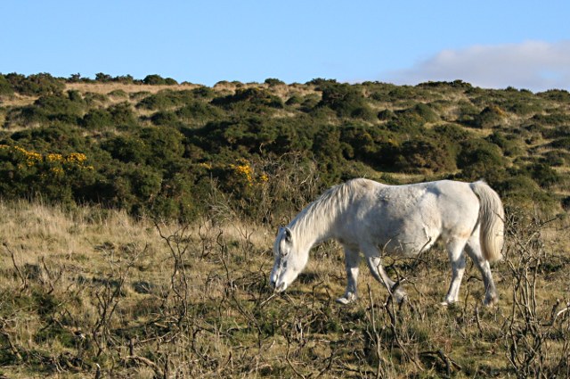
Image: © Tony Atkin Taken: 7 Dec 2008
Yennadon Down is an area of downland between Burrator Reservoir and Dousland. The vegetation is a mixture of grassland and gorse grazed mainly by ponies. The gorse needs to be occasionally burned to keep it down. Once the gorse has been burned the blackened branches often remain for a year or two, as can be seen in the foreground of this photograph.
Images are licensed for reuse under creativecommons.org/licenses/by-sa/2.0
Image Location
Latitude
50.498156
Longitude
-4.054287