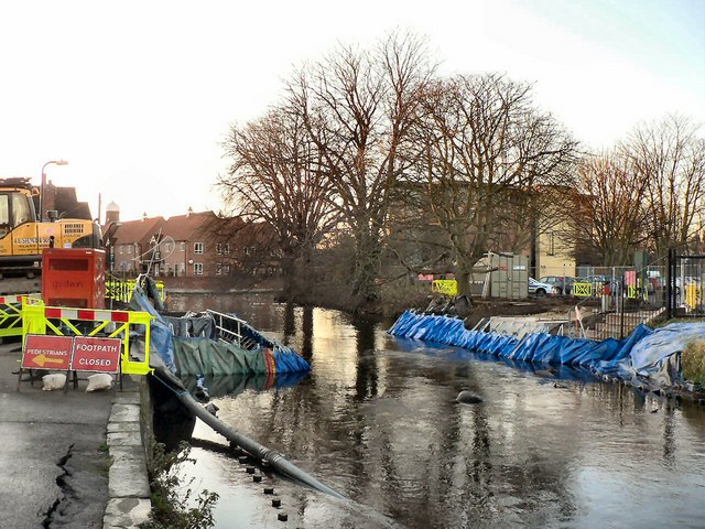
Bridge replacement on the Slea at Sleaford
Introduction
The photograph on this page of Bridge replacement on the Slea at Sleaford by Mick Lobb as part of the Geograph project.
The Geograph project started in 2005 with the aim of publishing, organising and preserving representative images for every square kilometre of Great Britain, Ireland and the Isle of Man.
There are currently over 7.5m images from over 14,400 individuals and you can help contribute to the project by visiting https://www.geograph.org.uk

Image: © Mick Lobb Taken: 3 Dec 2008
The earlier bridge is in the process of replacement so that a Dutch style lifting bridge can be erected as part of a project to make the Slea navigable once more. This will of course be for the tourist trade and not to support any other industry in the area. In the photograph cofferdams can be seen to have been constructed to allow for a dry working environment for the sinking of pillars to support the bridge structure on each side of the river. Because of the small size of the bridges, the timescale for the replacement is just six weeks.

