Ready for Development
Introduction
The photograph on this page of Ready for Development by Simon Carey as part of the Geograph project.
The Geograph project started in 2005 with the aim of publishing, organising and preserving representative images for every square kilometre of Great Britain, Ireland and the Isle of Man.

There are currently over 7.5m images from over 14,400 individuals and you can help contribute to the project by visiting https://www.geograph.org.uk
Ready for Development
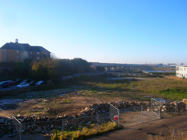
Image: © Simon Carey Taken: 7 Dec 2008
Taken from the embankment of the former Shoreham-Horsham line the small industrial unit that once occupied this spot has been demolished and is awaiting redevelopment. The railway and its bridge over the Adur is to the left with the northern edge of the Ropetackle development beyond it. A similar riverfront project may well be planned for this part.
Images are licensed for reuse under creativecommons.org/licenses/by-sa/2.0
Image Location
Latitude
50.83465
Longitude
-0.280801