Former Railway Bridge
Introduction
The photograph on this page of Former Railway Bridge by Simon Carey as part of the Geograph project.
The Geograph project started in 2005 with the aim of publishing, organising and preserving representative images for every square kilometre of Great Britain, Ireland and the Isle of Man.

There are currently over 7.5m images from over 14,400 individuals and you can help contribute to the project by visiting https://www.geograph.org.uk
Former Railway Bridge
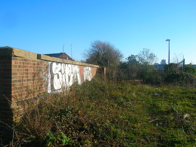
Image: © Simon Carey Taken: 7 Dec 2008
Taking the former Shoreham-Horsham line over the A283 towards the junction with the West Coastway. The line opened in 1861 and closed in 1966 though section between Shoreham and Beeding Cement Works remained open until 1981. The bridge has since been demolished with just the western parapet remaining whilst the eastern side is now occupied by car showroom.
Images are licensed for reuse under creativecommons.org/licenses/by-sa/2.0
Image Location
Latitude
50.834999
Longitude
-0.280078