Flood marker by the English Bridge
Introduction
The photograph on this page of Flood marker by the English Bridge by Stephen Craven as part of the Geograph project.
The Geograph project started in 2005 with the aim of publishing, organising and preserving representative images for every square kilometre of Great Britain, Ireland and the Isle of Man.

There are currently over 7.5m images from over 14,400 individuals and you can help contribute to the project by visiting https://www.geograph.org.uk
Flood marker by the English Bridge
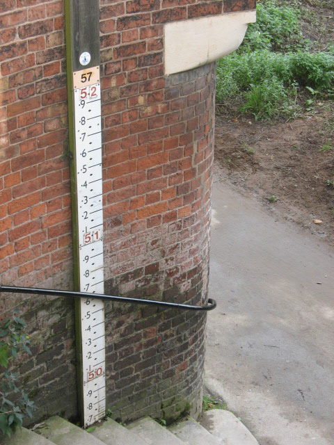
Image: © Stephen Craven Taken: 20 Nov 2008
The marker is adjacent to the steps leading down from the English Bridge to the footpath on the left bank of the Severn. The range shown is 49.7 to 52.0, which is presumably metres above Ordnance Datum (the map shows the 50m contour close to the river).
Images are licensed for reuse under creativecommons.org/licenses/by-sa/2.0
Image Location
Latitude
52.706449
Longitude
-2.748853