Fort Clarence, Rochester
Introduction
The photograph on this page of Fort Clarence, Rochester by David Anstiss as part of the Geograph project.
The Geograph project started in 2005 with the aim of publishing, organising and preserving representative images for every square kilometre of Great Britain, Ireland and the Isle of Man.

There are currently over 7.5m images from over 14,400 individuals and you can help contribute to the project by visiting https://www.geograph.org.uk
Fort Clarence, Rochester
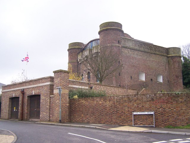
Image: © David Anstiss Taken: 30 Nov 2008
On junction of St Margarets Street and gun Tower Mews. Former military fort. Was part of the Medway group of Forts (Fort Luton, Amherst, Borstal and Horsted). Now converted into a large private house. Very good conversion keeping most of the forts brickwork. Land to rear of fort now used by Rochester Territorial Army Centre. For more details on history see http://www.borstal.org.uk/history/fort_clarence.shtml
Images are licensed for reuse under creativecommons.org/licenses/by-sa/2.0
Image Location
Latitude
51.381877
Longitude
0.498137