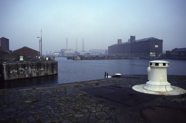
Historic dockland
Introduction
The photograph on this page of Historic dockland by Chris Allen as part of the Geograph project.
The Geograph project started in 2005 with the aim of publishing, organising and preserving representative images for every square kilometre of Great Britain, Ireland and the Isle of Man.
There are currently over 7.5m images from over 14,400 individuals and you can help contribute to the project by visiting https://www.geograph.org.uk

Image: © Chris Allen Taken: 15 Dec 1991
The water closest is the Princes Half Tide Dock with its entrance to the left. The right foreground capstan is almost certainly hydraulically powered. The East and West Waterloo Dock lead off into the distance with the tall block with two towers fronting the East Waterloo Dock. These are now apartments and housing is built on the bar between the two docks. The poorly seen vessel is the former Isle of Man Steam Packet Company (IOMSP) vessel Manxman. I think she was probably in Trafalgar dock and this is now largely infilled. The three chimneys are on the Clarence Dock Power Station - now demolished. On the original I can see the Victoria clock tower but this is a bit too much eye of faith on this reproduction. I had rather forgotten what a wealth of detail I had captured on a really freezing December morning.

