Plas Llanmihangel
Introduction
The photograph on this page of Plas Llanmihangel by M Hunter as part of the Geograph project.
The Geograph project started in 2005 with the aim of publishing, organising and preserving representative images for every square kilometre of Great Britain, Ireland and the Isle of Man.

There are currently over 7.5m images from over 14,400 individuals and you can help contribute to the project by visiting https://www.geograph.org.uk
Plas Llanmihangel
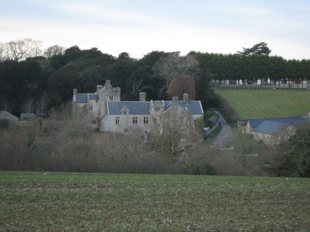
Image: © M Hunter Taken: 30 Nov 2008
Plas Llanmihangel has been described by The Royal Commission on Ancient Monuments as "one of the finest and most complete gentry houses in Glamorgan". The house was first recorded in 1166 as a Grange occupied by a Norman Knight named John Norreys
Images are licensed for reuse under creativecommons.org/licenses/by-sa/2.0
Image Location
Latitude
51.437261
Longitude
-3.467401