Cemetery and church, Heavitree
Introduction
The photograph on this page of Cemetery and church, Heavitree by Derek Harper as part of the Geograph project.
The Geograph project started in 2005 with the aim of publishing, organising and preserving representative images for every square kilometre of Great Britain, Ireland and the Isle of Man.

There are currently over 7.5m images from over 14,400 individuals and you can help contribute to the project by visiting https://www.geograph.org.uk
Cemetery and church, Heavitree
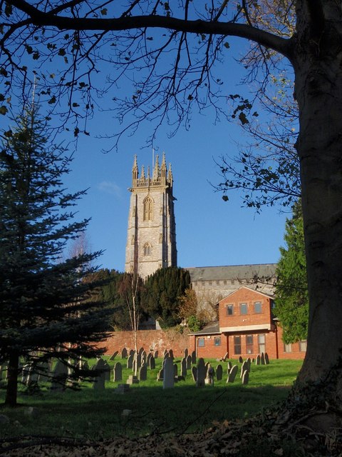
Image: © Derek Harper Taken: 25 Nov 2008
From beneath a tree at the corner of Church Street and Church Lane, a view across the lower cemetery, past the church hall on the right, and with the tower of Image ahead.
Images are licensed for reuse under creativecommons.org/licenses/by-sa/2.0
Image Location
Latitude
50.719596
Longitude
-3.506206