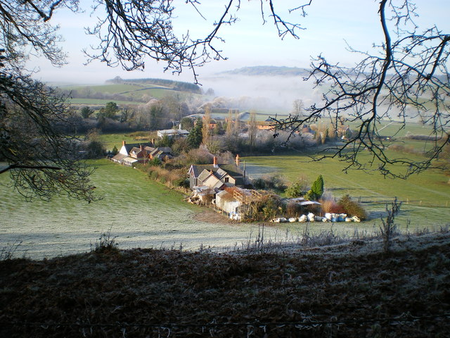
The settlement at Bachaethlon
Introduction
The photograph on this page of The settlement at Bachaethlon by Richard Law as part of the Geograph project.
The Geograph project started in 2005 with the aim of publishing, organising and preserving representative images for every square kilometre of Great Britain, Ireland and the Isle of Man.
There are currently over 7.5m images from over 14,400 individuals and you can help contribute to the project by visiting https://www.geograph.org.uk

Image: © Richard Law Taken: 30 Nov 2008
Photographed from the public footpath on Hopton Uchaf hill. Bachaethlon does not form part of 'The City' which is a very specific collection of houses in an almost closed dingle to the left of this picture. This name is probably C19th whereas the term Bachaethlon was a 'township' in the parish of Kerry, with references possibly as far back as the C14th. The photo captures the probable lines of a mediaeval field system showing in the frosted ground to the immediate left of the first house. These lines are seen very rarely. On the right of the house immediately below are showing two probable boundaries (once hedges?) of uncertain age. In the field in which these are found is also evidence of ridge and furrow which show more clearly - even without frost or snow and further to the right of them (but obscured by the branch in the picture) are 'platforms' and ditches that indicate some form of settlement (again of uncertain age but probably mediaeval). Thanks to Ian Ball for this local knowledge

