The changing face of Stafford
Introduction
The photograph on this page of The changing face of Stafford by Simon Huguet as part of the Geograph project.
The Geograph project started in 2005 with the aim of publishing, organising and preserving representative images for every square kilometre of Great Britain, Ireland and the Isle of Man.

There are currently over 7.5m images from over 14,400 individuals and you can help contribute to the project by visiting https://www.geograph.org.uk
The changing face of Stafford
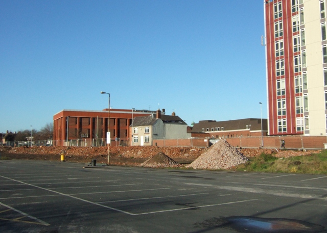
Image: © Simon Huguet Taken: 25 Nov 2008
Looking into the town centre across the car park of the former Riverside Sports Centre. The old town's South Wall ran along the line of rubble that until recently was a terrace of houses. To the left are the Magistrate's Courts, next to the Police Station. The old house is a former pub, now offices known as Oriel House, and the tower block to the right is the Telecoms building. This townscape will not last for long - planning consent has been granted to the County Council for a huge office complex which will fill the skyline behind the Courts and there are also plans for an apartment complex on the former Riverside site.
Images are licensed for reuse under creativecommons.org/licenses/by-sa/2.0
Image Location


Leaflet Map data © OpenStreetMap
Latitude
52.805758
Longitude
-2.113586