The Craigmore Viaduct
Introduction
The photograph on this page of The Craigmore Viaduct by HENRY CLARK as part of the Geograph project.
The Geograph project started in 2005 with the aim of publishing, organising and preserving representative images for every square kilometre of Great Britain, Ireland and the Isle of Man.

There are currently over 7.5m images from over 14,400 individuals and you can help contribute to the project by visiting https://www.geograph.org.uk
The Craigmore Viaduct
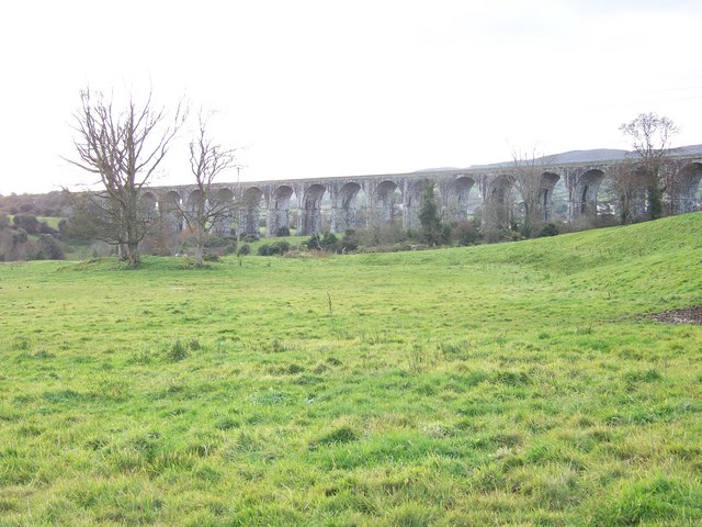
Image: © HENRY CLARK Taken: 24 Nov 2008
Construction began on Craigmore Viaduct in 1849 and the bridge was opened in 1852. The 18 arch viaduct designed by Sir John O’Neill sweeps across the valley of Camlough River, the highest arch being 126ft making it the highest viaduct in Ireland. It is around a quarter of a mile in length and it consists of the finest granite from the surrounding countryside. The viaduct now carries the Enterprise Train link from Belfast to Dublin.
Images are licensed for reuse under creativecommons.org/licenses/by-sa/2.0
Image Location
Latitude
54.196193
Longitude
-6.366677