Ballards Lane
Introduction
The photograph on this page of Ballards Lane by Martin Addison as part of the Geograph project.
The Geograph project started in 2005 with the aim of publishing, organising and preserving representative images for every square kilometre of Great Britain, Ireland and the Isle of Man.

There are currently over 7.5m images from over 14,400 individuals and you can help contribute to the project by visiting https://www.geograph.org.uk
Ballards Lane
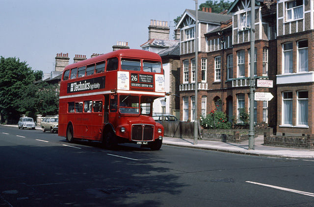
Image: © Martin Addison Taken: Unknown
RM1295 on the 26 passes the junction with Granville Road with a service for Golders Green. Please see Image for the same location in 2010.
Images are licensed for reuse under creativecommons.org/licenses/by-sa/2.0
Image Location
Latitude
51.608878
Longitude
-0.182101