The Upper Drive, Hove
Introduction
The photograph on this page of The Upper Drive, Hove by Simon Carey as part of the Geograph project.
The Geograph project started in 2005 with the aim of publishing, organising and preserving representative images for every square kilometre of Great Britain, Ireland and the Isle of Man.

There are currently over 7.5m images from over 14,400 individuals and you can help contribute to the project by visiting https://www.geograph.org.uk
The Upper Drive, Hove
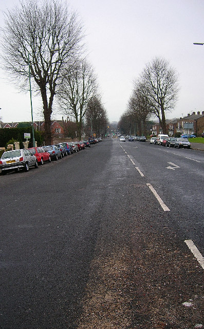
Image: © Simon Carey Taken: 14 Jan 2006
One of the routes out of central Hove The Upper Drive begins at The Drive (B2185) before bisecting the Old Shoreham Road (A270) at an angle before heading up this hill and ending at Dyke Road. Originally an old farm track the road still gives the impression of space as little housing has been built on either side. The buildings on the left form Cardinal Newman RC School and those on the right are a 60s built executive estate. This view was taken from the Dyke Road junction in the top north east corner of the square and looks south west down the hill towards the junction with Old Shoreham Road.
Images are licensed for reuse under creativecommons.org/licenses/by-sa/2.0
Image Location
Latitude
50.837205
Longitude
-0.159418