Havoc Hole
Introduction
The photograph on this page of Havoc Hole by Lairich Rig as part of the Geograph project.
The Geograph project started in 2005 with the aim of publishing, organising and preserving representative images for every square kilometre of Great Britain, Ireland and the Isle of Man.

There are currently over 7.5m images from over 14,400 individuals and you can help contribute to the project by visiting https://www.geograph.org.uk
Havoc Hole
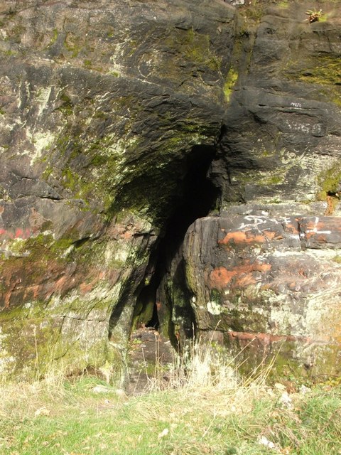
Image: © Lairich Rig Taken: 21 Nov 2008
For a discussion of the cave's traditional associations with William Wallace, see the main article: Image The cave opening here is a little over six feet high. The passage rapidly narrows, so that it is not possible to progress more than a few feet into the cave; it was perhaps deliberately blocked to prevent people from disappearing into it.
Images are licensed for reuse under creativecommons.org/licenses/by-sa/2.0
Image Location
Latitude
55.945714
Longitude
-4.594568