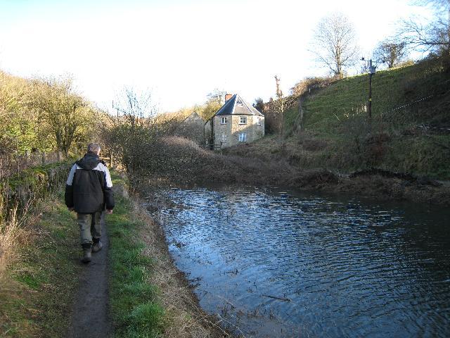
Puck Mill Upper Lock
Introduction
The photograph on this page of Puck Mill Upper Lock by David Stowell as part of the Geograph project.
The Geograph project started in 2005 with the aim of publishing, organising and preserving representative images for every square kilometre of Great Britain, Ireland and the Isle of Man.
There are currently over 7.5m images from over 14,400 individuals and you can help contribute to the project by visiting https://www.geograph.org.uk

Image: © David Stowell Taken: 30 Jan 2008
This lock on the Thames & Severn Canal is to the left of the unusual lock keeper's cottage and has an aqueduct underneath over the River Frome. The pound visible in the picture between the two Puck Mill Locks was completely relined with clay in the early 1900s but today it leaks like a sieve and only holds water after exceptionally wet periods. No prizes for guessing what the weather had been like in the days just before this picture was taken!

