The Blossomgate - Marshall Way junction
Introduction
The photograph on this page of The Blossomgate - Marshall Way junction by Gordon Hatton as part of the Geograph project.
The Geograph project started in 2005 with the aim of publishing, organising and preserving representative images for every square kilometre of Great Britain, Ireland and the Isle of Man.

There are currently over 7.5m images from over 14,400 individuals and you can help contribute to the project by visiting https://www.geograph.org.uk
The Blossomgate - Marshall Way junction
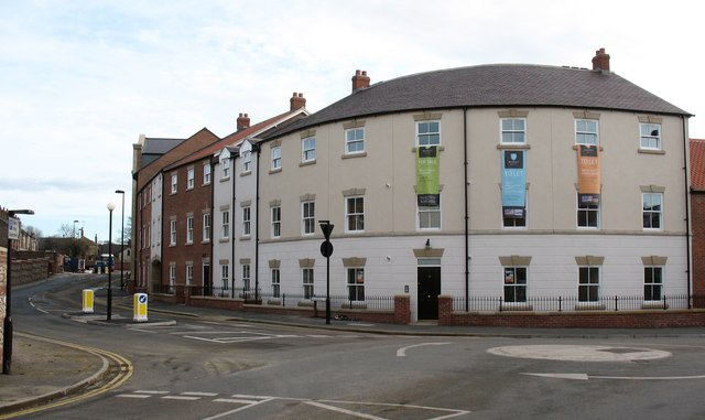
Image: © Gordon Hatton Taken: 19 Nov 2008
All of this is new development constructed in 2008. Marshall Way [left] is a new road leading to a car park and retail development which is hidden by these new apartment blocks which face on to Blossomgate. The apartments stand on the site of a former Rover dealership [remember those?].
Images are licensed for reuse under creativecommons.org/licenses/by-sa/2.0
Image Location


Leaflet Map data © OpenStreetMap
Latitude
54.137059
Longitude
-1.526258