Eighteenth century houses, Foots Cray
Introduction
The photograph on this page of Eighteenth century houses, Foots Cray by David Kemp as part of the Geograph project.
The Geograph project started in 2005 with the aim of publishing, organising and preserving representative images for every square kilometre of Great Britain, Ireland and the Isle of Man.

There are currently over 7.5m images from over 14,400 individuals and you can help contribute to the project by visiting https://www.geograph.org.uk
Eighteenth century houses, Foots Cray
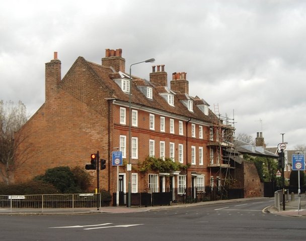
Image: © David Kemp Taken: 20 Nov 2008
The picture was taken from Cray Road at the crossroads in the centre of Foots Cray. The houses are situated in Rectory Lane, date from the early eighteenth century and are part of what little remains of the original village. Sidcup Hill is to the left and to the right is Foots Cray High Street.
Images are licensed for reuse under creativecommons.org/licenses/by-sa/2.0
Image Location
Latitude
51.419136
Longitude
0.11786