Dudbridge Road bridge and lock
Introduction
The photograph on this page of Dudbridge Road bridge and lock by David Stowell as part of the Geograph project.
The Geograph project started in 2005 with the aim of publishing, organising and preserving representative images for every square kilometre of Great Britain, Ireland and the Isle of Man.

There are currently over 7.5m images from over 14,400 individuals and you can help contribute to the project by visiting https://www.geograph.org.uk
Dudbridge Road bridge and lock
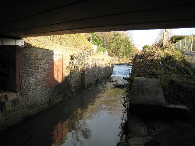
Image: © David Stowell Taken: 9 Jan 2008
This length of the Stroudwater Canal was converted into a flood relief channel in 1956 and the locks here at Dudbridge road had their gates removed and weirs installed. This is the lower, or Franklin's Lock (named after the builder) and forms a single structure with Dudbridge Road bridge. The lock chamber is generally in good condition and the main restoration work will be the provision of new gates and paddles, along with additional bypass culverts to maintain the flood flow capability.
Images are licensed for reuse under creativecommons.org/licenses/by-sa/2.0
Image Location
Latitude
51.741657
Longitude
-2.240369