Bascule Bridge, St Peter's Basin
Introduction
The photograph on this page of Bascule Bridge, St Peter's Basin by Oliver Dixon as part of the Geograph project.
The Geograph project started in 2005 with the aim of publishing, organising and preserving representative images for every square kilometre of Great Britain, Ireland and the Isle of Man.

There are currently over 7.5m images from over 14,400 individuals and you can help contribute to the project by visiting https://www.geograph.org.uk
Bascule Bridge, St Peter's Basin
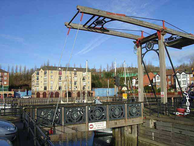
Image: © Oliver Dixon Taken: 18 Nov 2008
The bascule bridge at the mouth of St Peter's Basin, a trendy new marina surrounded by smart new housing. Seen on a largely traffic-free route along the north side of the Tyne which is followed by both Hadrian's Wall National Trail http://www.nationaltrail.co.uk/hadrianswall/ and by route 72 of the National Cycle Network (Hadrian's Cycleway http://www.cycle-routes.org/HADRIANSCYCLEWAY/ and the Tynemouth branch of the C2C Cycle Route http://www.c2c-guide.co.uk/).
Images are licensed for reuse under creativecommons.org/licenses/by-sa/2.0
Image Location


Leaflet Map data © OpenStreetMap
Latitude
54.965558
Longitude
-1.573261