Kingswear and Dartmouth
Introduction
The photograph on this page of Kingswear and Dartmouth by Tom Jolliffe as part of the Geograph project.
The Geograph project started in 2005 with the aim of publishing, organising and preserving representative images for every square kilometre of Great Britain, Ireland and the Isle of Man.

There are currently over 7.5m images from over 14,400 individuals and you can help contribute to the project by visiting https://www.geograph.org.uk
Kingswear and Dartmouth
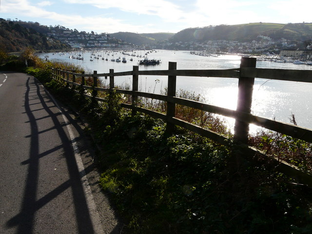
Image: © Tom Jolliffe Taken: 19 Nov 2008
The road down to the higher ferry on the Kingswear side gives a good view of the marina, the two towns and the wide river which made the port an important military base. Noss Quay, a little further up on the Kingswear side, is a deep water port.
Images are licensed for reuse under creativecommons.org/licenses/by-sa/2.0
Image Location
Latitude
50.361736
Longitude
-3.574565