
Amersham Telephone Exchange
Introduction
The photograph on this page of Amersham Telephone Exchange by David Hillas as part of the Geograph project.
The Geograph project started in 2005 with the aim of publishing, organising and preserving representative images for every square kilometre of Great Britain, Ireland and the Isle of Man.

There are currently over 7.5m images from over 14,400 individuals and you can help contribute to the project by visiting https://www.geograph.org.uk
Amersham Telephone Exchange
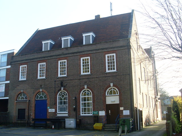
Image: © David Hillas Taken: 12 Nov 2008
Situated in Chesham Road, this building was the Post Office until the mid 1960s and housed the Manual TE until mid-1969. It has the code SMAM and serves 7,269 residential and 422 non-residential premises in Amersham, plus Chesham Bois, Coleshill and Winchmore Hill nearby. Two square BT warning notices can be seen on the front of the building whilst a yellow grit salt bin is below them. The numbering range of this TE is (01494) 43xxxx, 72xxxx, the (01494) referring to the High Wycombe group of TEs, and its postcode is HP6 5EZ.
Images are licensed for reuse under creativecommons.org/licenses/by-sa/2.0
Image Location

Latitude
51.675762
Longitude
-0.608546