
Carrycoats Hall
Introduction
The photograph on this page of Carrycoats Hall by Les Hull as part of the Geograph project.
The Geograph project started in 2005 with the aim of publishing, organising and preserving representative images for every square kilometre of Great Britain, Ireland and the Isle of Man.

There are currently over 7.5m images from over 14,400 individuals and you can help contribute to the project by visiting https://www.geograph.org.uk
Carrycoats Hall
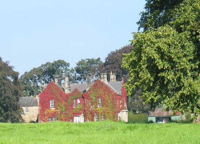
Image: © Les Hull Taken: 9 Sep 2004
Keys to the Past Web Site: This house was built in the mid-19th century but seems to have been built around an earlier building. Old documents from 1541 record a bastle at Carrycoats and some of the walls of the house are like those of a bastle, built of rough rubble walling with large roughly-shaped corner stones. The oldest part of the building measures 7.7m by 6m and its walls are about 0.9m thick.
Images are licensed for reuse under creativecommons.org/licenses/by-sa/2.0
Image Location

Latitude
55.113439
Longitude
-2.119112