Remains of Sawpit, Bottom Wood
Introduction
The photograph on this page of Remains of Sawpit, Bottom Wood by David Ellis as part of the Geograph project.
The Geograph project started in 2005 with the aim of publishing, organising and preserving representative images for every square kilometre of Great Britain, Ireland and the Isle of Man.

There are currently over 7.5m images from over 14,400 individuals and you can help contribute to the project by visiting https://www.geograph.org.uk
Remains of Sawpit, Bottom Wood
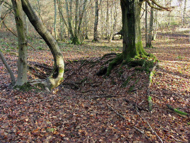
Image: © David Ellis Taken: 11 Jan 2006
The pit is now partly filled; originally one man would have stood inside, the other on top. The Chilterns wood trade was at its height between the 16th and 19th centuries.
Images are licensed for reuse under creativecommons.org/licenses/by-sa/2.0
Image Location
Latitude
51.654506
Longitude
-0.855092