Gott, Tingwall
Introduction
The photograph on this page of Gott, Tingwall by Mike Pennington as part of the Geograph project.
The Geograph project started in 2005 with the aim of publishing, organising and preserving representative images for every square kilometre of Great Britain, Ireland and the Isle of Man.

There are currently over 7.5m images from over 14,400 individuals and you can help contribute to the project by visiting https://www.geograph.org.uk
Gott, Tingwall
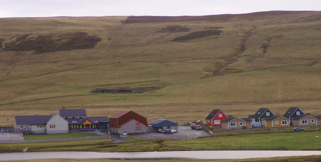
Image: © Mike Pennington Taken: 12 Nov 2008
Although known as 'Gott' on the map, the name is controversial locally. Gott was originally only the name of the farm nearby, but it was adopted as the name of the local telephone exchange because the GPO (as it was at the time) thought that users would get confused with Dingwall in Ross & Cromarty. The school on the left is, nevertheless, known as Gott Primary School. The abandoned croft of Greenwall is on the slopes of the Hill of Herrislee in the background. Strand Loch is in the foreground.
Images are licensed for reuse under creativecommons.org/licenses/by-sa/2.0
Image Location
Latitude
60.194126
Longitude
-1.222206