Bridge Inn, Cinderford, Forest of Dean
Introduction
The photograph on this page of Bridge Inn, Cinderford, Forest of Dean by Eric Soons as part of the Geograph project.
The Geograph project started in 2005 with the aim of publishing, organising and preserving representative images for every square kilometre of Great Britain, Ireland and the Isle of Man.

There are currently over 7.5m images from over 14,400 individuals and you can help contribute to the project by visiting https://www.geograph.org.uk
Bridge Inn, Cinderford, Forest of Dean
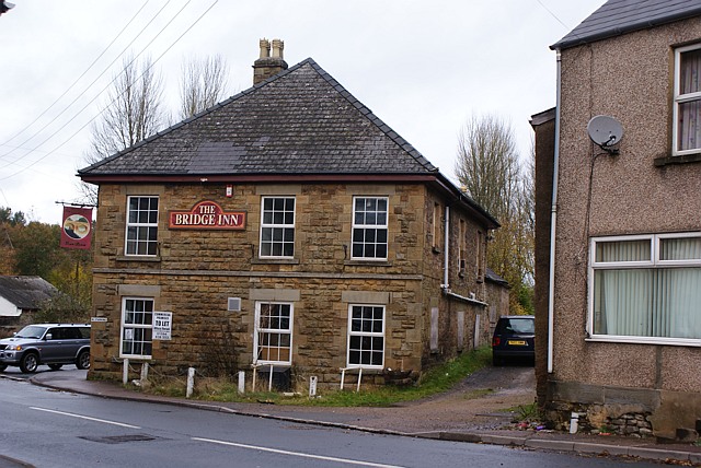
Image: © Eric Soons Taken: 11 Nov 2008
The Bridge Inn stands on the corner of Saint White's road and Valley road at the very South Western corner of Cinderford. It has now closed as an Inn or public house. The alley-like gravelled lane to the right of the Inn was a tram road, sometimes called locally a Dram Road. The roof, it is of a type called 'hipped, signifies that it is an important building - the only other one nearby is that of the one-time Mine Manager which still stands on a little knoll to the North East of the Bridge Inn.
Images are licensed for reuse under creativecommons.org/licenses/by-sa/2.0
Image Location
Latitude
51.811117
Longitude
-2.507489