Reigate Methodist Church
Introduction
The photograph on this page of Reigate Methodist Church by Ian Capper as part of the Geograph project.
The Geograph project started in 2005 with the aim of publishing, organising and preserving representative images for every square kilometre of Great Britain, Ireland and the Isle of Man.

There are currently over 7.5m images from over 14,400 individuals and you can help contribute to the project by visiting https://www.geograph.org.uk
Reigate Methodist Church
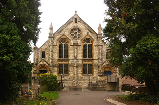
Image: © Ian Capper Taken: 27 Aug 2008
Built in 1884 of Reigate Stone, with the congregation moving from their chapel in nearby Nutley Lane. For close ups of the foundation stones, seven of which are visible in this photo below the windows, see http://www.geograph.org.uk/search.php?i=4254397. Perhaps the most famous member of the congregation here was J Arthur Rank (of flour and film fame) who was Sunday School superintendent for many years and who opened the Rank Hall (situated behind the church - see Image) in 1954.
Images are licensed for reuse under creativecommons.org/licenses/by-sa/2.0
Image Location
Latitude
51.237476
Longitude
-0.208985