Gunnislake Station
Introduction
The photograph on this page of Gunnislake Station by roger geach as part of the Geograph project.
The Geograph project started in 2005 with the aim of publishing, organising and preserving representative images for every square kilometre of Great Britain, Ireland and the Isle of Man.

There are currently over 7.5m images from over 14,400 individuals and you can help contribute to the project by visiting https://www.geograph.org.uk
Gunnislake Station
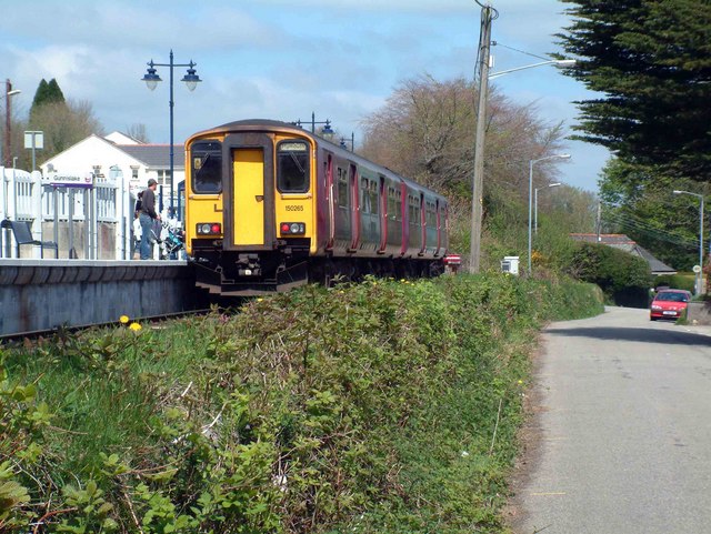
Image: © roger geach Taken: 29 Apr 2006
This is the new Gunnislake Station that was built across the road from the original station. This allowed the low bridge that spanned the main road to be demolished. In the 60s the railway ran past Gunnislake onward to Callington where the station was actually situated in Kelly Bray. This was shut along with many other West Country branch lines by Beeching. Gunnislake has only survived due to the poor roads that link Plymouth and the Tamer valley area which prevents a reasonable substitute bus service.
Images are licensed for reuse under creativecommons.org/licenses/by-sa/2.0
Image Location
Latitude
50.516078
Longitude
-4.219546