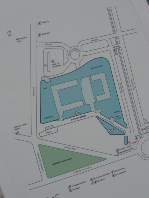
Map of Westfield shopping centre
Introduction
The photograph on this page of Map of Westfield shopping centre by David Hawgood as part of the Geograph project.
The Geograph project started in 2005 with the aim of publishing, organising and preserving representative images for every square kilometre of Great Britain, Ireland and the Isle of Man.
There are currently over 7.5m images from over 14,400 individuals and you can help contribute to the project by visiting https://www.geograph.org.uk

Image: © David Hawgood Taken: 6 Nov 2008
[At November 2008] This is on an information board outside Shepherds Bush Overground Station, on the southern approach into the shopping centre. I couldn't find an online map of the centre and the new road layout, so took this for my own use. Wood Lane, on the left, runs north-south, and the photo is aligned to make this run vertically. [Addition 20 November 2008] Westfield is now shown on the Ordnance Survey large scale online maps. [Addition October 2017] A major expansion of Westfield is due to open in March 2018

