Cycleway junction near Scotswood Bridge
Introduction
The photograph on this page of Cycleway junction near Scotswood Bridge by Oliver Dixon as part of the Geograph project.
The Geograph project started in 2005 with the aim of publishing, organising and preserving representative images for every square kilometre of Great Britain, Ireland and the Isle of Man.

There are currently over 7.5m images from over 14,400 individuals and you can help contribute to the project by visiting https://www.geograph.org.uk
Cycleway junction near Scotswood Bridge
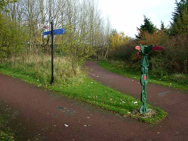
Image: © Oliver Dixon Taken: 8 Nov 2008
One of the most important junctions on the entire National Cycle Network. At this point, the northern arm of the C2C Cycle route http://www.c2c-guide.co.uk/ after traversing the Derwent valley crosses the Scotswood Road by footbridge to join Hadrian's Way which carries both Hadrian's Cycleway http://www.cycle-routes.org/HADRIANSCYCLEWAY/ and Hadrian's Wall National Trail http://www.nationaltrail.co.uk/hadrianswall/. The milepost pictured is one of a thousand donated to the National Cycle Network project by the Bank of Scotland. This particular one is of the "Welsh" design, by Andrew Rowe and takes its inspiration from Welsh love-spoons http://www.sustrans.org.uk/default.asp?sID=1132763167625.
Images are licensed for reuse under creativecommons.org/licenses/by-sa/2.0
Image Location


Leaflet Map data © OpenStreetMap
Latitude
54.968418
Longitude
-1.686476