Bridge over the Worth Way, Crawley Down carrying the B2028 Turners Hill Road
Introduction
The photograph on this page of Bridge over the Worth Way, Crawley Down carrying the B2028 Turners Hill Road by CDSnapper as part of the Geograph project.
The Geograph project started in 2005 with the aim of publishing, organising and preserving representative images for every square kilometre of Great Britain, Ireland and the Isle of Man.

There are currently over 7.5m images from over 14,400 individuals and you can help contribute to the project by visiting https://www.geograph.org.uk
Bridge over the Worth Way, Crawley Down carrying the B2028 Turners Hill Road
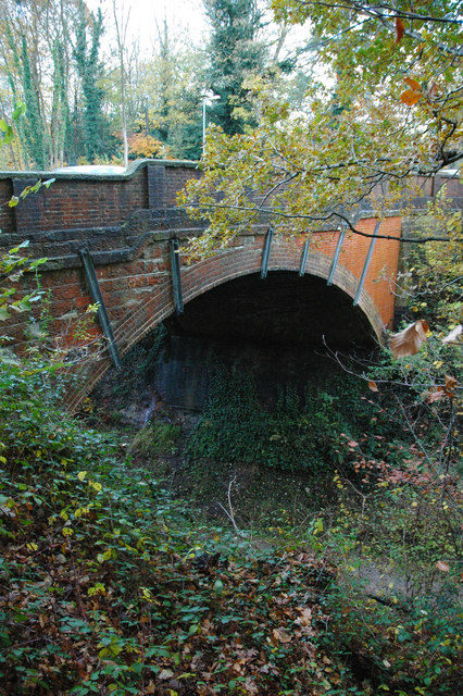
Image: © CDSnapper Taken: 8 Nov 2008
This bridge carries the B2028 Turners Hill Road over the disused railway line that is now the Worth Way footpath. The abutments are formed on the cutting rock, part of the Tunbridge Wells Sand.
Images are licensed for reuse under creativecommons.org/licenses/by-sa/2.0
Image Location
Latitude
51.118926
Longitude
-0.084373