Cyclists at Rookhope
Introduction
The photograph on this page of Cyclists at Rookhope by Oliver Dixon as part of the Geograph project.
The Geograph project started in 2005 with the aim of publishing, organising and preserving representative images for every square kilometre of Great Britain, Ireland and the Isle of Man.

There are currently over 7.5m images from over 14,400 individuals and you can help contribute to the project by visiting https://www.geograph.org.uk
Cyclists at Rookhope
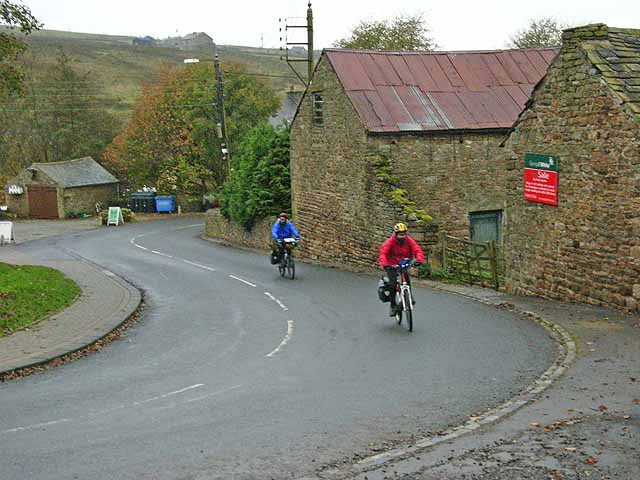
Image: © Oliver Dixon Taken: 5 Nov 2008
Rookhope lies on the C2C http://www.c2c-guide.co.uk/aboutc2c.htm (coast to coast) cycleway (National Cycle Network route 7). The C2C is Britain's best known cycleway and is completed by tens of thousands of cyclists every year. At this point, cyclists have just enjoyed a long speedy descent of the Rookhope valley and are about to be confronted with the notorious Rookhope Incline, a long off-road push. The cyclists in view are Israelis on a fact-finding visit to help them plan a long-distance cycle route running the length of Israel. The weather in Israel is rather warmer!
Images are licensed for reuse under creativecommons.org/licenses/by-sa/2.0
Image Location


Leaflet Map data © OpenStreetMap
Latitude
54.780968
Longitude
-2.097297