Waterlinks House
Introduction
The photograph on this page of Waterlinks House by Graham Taylor as part of the Geograph project.
The Geograph project started in 2005 with the aim of publishing, organising and preserving representative images for every square kilometre of Great Britain, Ireland and the Isle of Man.

There are currently over 7.5m images from over 14,400 individuals and you can help contribute to the project by visiting https://www.geograph.org.uk
Waterlinks House
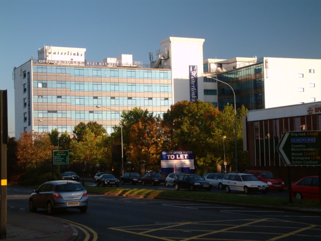
Image: © Graham Taylor Taken: 10 Oct 2005
Built in the sixties as a 'flatted factory' the building housed numerous small industrial units. It has now been converted into office accommodation.
Images are licensed for reuse under creativecommons.org/licenses/by-sa/2.0
Image Location
Latitude
52.490398
Longitude
-1.885376