Stocks Bridge at Stocksbridge
Introduction
The photograph on this page of Stocks Bridge at Stocksbridge by Terry Robinson as part of the Geograph project.
The Geograph project started in 2005 with the aim of publishing, organising and preserving representative images for every square kilometre of Great Britain, Ireland and the Isle of Man.

There are currently over 7.5m images from over 14,400 individuals and you can help contribute to the project by visiting https://www.geograph.org.uk
Stocks Bridge at Stocksbridge
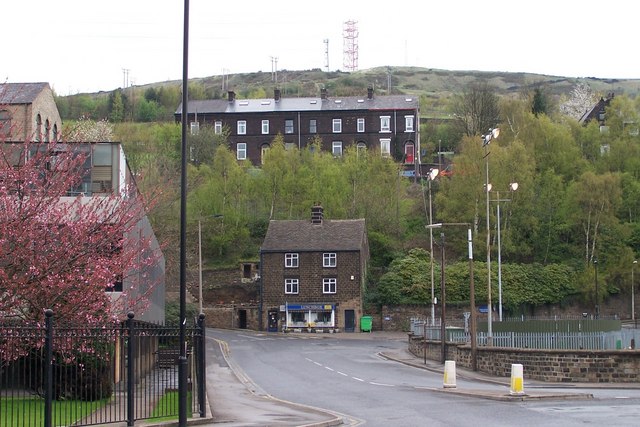
Image: © Terry Robinson Taken: 30 Apr 2008
This picture links off to the left with the 'Samuel Fox' and 'Corus' pictures. The piece of road between 'The Lunchbox' and the 'Bollards' is actually a bridge over the original course of the Little Don (or Porter) River. This bridge was on some land owned by a John Stocks so it became known as Stocks Bridge ... so now you know!*** The 'Lunchbox' House and the Prospect Cottages Terrace behind are both shown on the 1903 Stocksbridge Map and will have seen many changes over the years. Image Image *** Update in January 2014 There is now a doubt as to the truth of this information … with a current thought being that it is more to do with the site of some Monastic Buildings I'll try to verify this in due course
Images are licensed for reuse under creativecommons.org/licenses/by-sa/2.0
Image Location
Latitude
53.483055
Longitude
-1.589779