The old and the new, Eaton Gardens
Introduction
The photograph on this page of The old and the new, Eaton Gardens by Simon Carey as part of the Geograph project.
The Geograph project started in 2005 with the aim of publishing, organising and preserving representative images for every square kilometre of Great Britain, Ireland and the Isle of Man.

There are currently over 7.5m images from over 14,400 individuals and you can help contribute to the project by visiting https://www.geograph.org.uk
The old and the new, Eaton Gardens
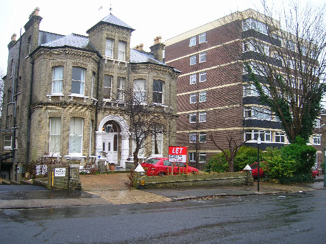
Image: © Simon Carey Taken: 8 Jan 2006
The building on the left was once part of a number of similarly built gothic style Victorian mansions that lined this side of the street. This one has survivied because it has become a nursing home. Unfortunately, its neighbours either side have succumbed and become a modern block of flats. This is very much the trend in Hove as the land these mansions are built on become more valuable than the buildings themselves. Mansions like these can be converted into 8 or 9 flats but there is more money in taller, newer blocks. Eaton Gardens runs south from the B2120 its southerly junction being split between this square and TQ2804. This picture has been taken halfway down the road and looks to the east.
Images are licensed for reuse under creativecommons.org/licenses/by-sa/2.0
Image Location
Latitude
50.831968
Longitude
-0.169565