Tavistock: River Tavy and Abbey Bridge
Introduction
The photograph on this page of Tavistock: River Tavy and Abbey Bridge by Nigel Cox as part of the Geograph project.
The Geograph project started in 2005 with the aim of publishing, organising and preserving representative images for every square kilometre of Great Britain, Ireland and the Isle of Man.

There are currently over 7.5m images from over 14,400 individuals and you can help contribute to the project by visiting https://www.geograph.org.uk
Tavistock: River Tavy and Abbey Bridge
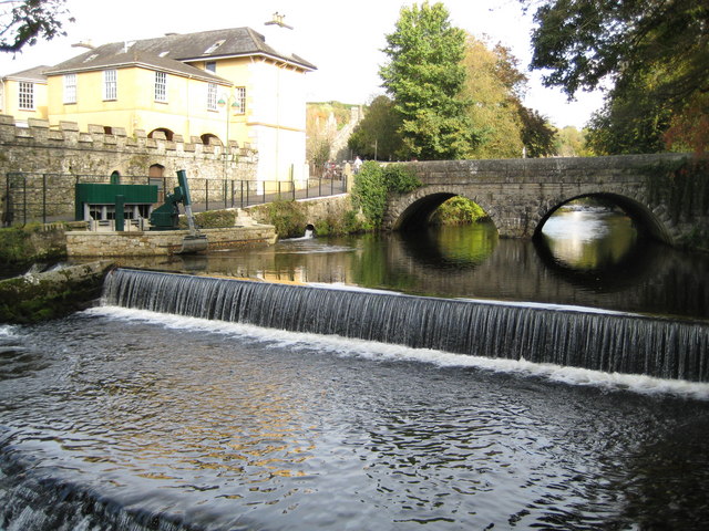
Image: © Nigel Cox Taken: 17 Oct 2008
Quoting from the Devon County Council's plaque on Abbey Bridge:- "A mediaeval bridge here served Tavistock Abbey. It was replaced in 1763 to accommodate the new turnpike road system. This bridge was widened in 1860 to carry increased traffic following the opening of the Great Western Railway station nearby." Today it carries the A386 road to and from Okehampton into the town centre. On the left is the intake from the River Tavy that feeds the Tavistock Canal which has served Morwellham hydro power station since 1934. In 2008 a new automatic screening mechanism was installed (the green and grey shovel-like structure) that will prevent salmon smolts from entering the canal and becoming trapped, instead allowing them to swim down the Tavy to the sea.
Images are licensed for reuse under creativecommons.org/licenses/by-sa/2.0
Image Location
Latitude
50.548796
Longitude
-4.143867