Harkerside Field Systems
Introduction
The photograph on this page of Harkerside Field Systems by Gordon Hatton as part of the Geograph project.
The Geograph project started in 2005 with the aim of publishing, organising and preserving representative images for every square kilometre of Great Britain, Ireland and the Isle of Man.

There are currently over 7.5m images from over 14,400 individuals and you can help contribute to the project by visiting https://www.geograph.org.uk
Harkerside Field Systems
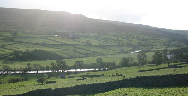
Image: © Gordon Hatton Taken: 26 Oct 2008
The view across the Swale towards Harkerside, where in the low afternoon light it is possible to pick out the lines and humps of ancient fields and tracks, most likely dating from the iron age and probably constructed by the local Brigantes tribe.
Images are licensed for reuse under creativecommons.org/licenses/by-sa/2.0
Image Location
Latitude
54.382708
Longitude
-1.96517