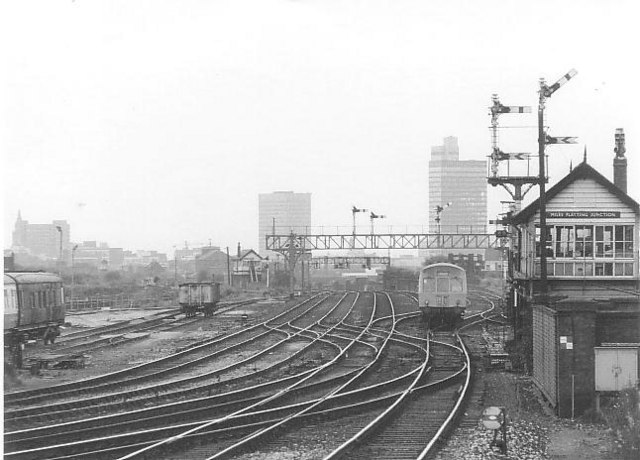
Miles Platting junction
Introduction
The photograph on this page of Miles Platting junction by Peter Whatley as part of the Geograph project.
The Geograph project started in 2005 with the aim of publishing, organising and preserving representative images for every square kilometre of Great Britain, Ireland and the Isle of Man.
There are currently over 7.5m images from over 14,400 individuals and you can help contribute to the project by visiting https://www.geograph.org.uk

Image: © Peter Whatley Taken: Unknown
The 17.37 Manchester Victoria-Leeds train approaches Miles Platting junction and its already aged signalbox. For about a decade, this was the only train using the old Lancashire & Yorkshire line across the Pennines which called at Miles Platting station. In 1977, Manchester's skyline had just two high-rise blocks, both of which are visible in the photograph. On the left, the much-derided Arndale tower from the early 1970s; to the right the CIS tower from a decade earlier. Compare with my photograph from the same spot a decade later!

