The Flint House, Selmeston
Introduction
The photograph on this page of The Flint House, Selmeston by Kevin Gordon as part of the Geograph project.
The Geograph project started in 2005 with the aim of publishing, organising and preserving representative images for every square kilometre of Great Britain, Ireland and the Isle of Man.

There are currently over 7.5m images from over 14,400 individuals and you can help contribute to the project by visiting https://www.geograph.org.uk
The Flint House, Selmeston
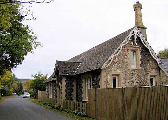
Image: © Kevin Gordon Taken: 14 Oct 2008
This is the former school for the village. There are three dates on the building - here at the north end, 1847, at the south end 1876 and the date 1846 over the door. The building is faced with knapped flints and is now known as "The Flint House". It is a grade II listed building.
Images are licensed for reuse under creativecommons.org/licenses/by-sa/2.0
Image Location
Latitude
50.840554
Longitude
0.139848